Watershed and Surrounding Areas
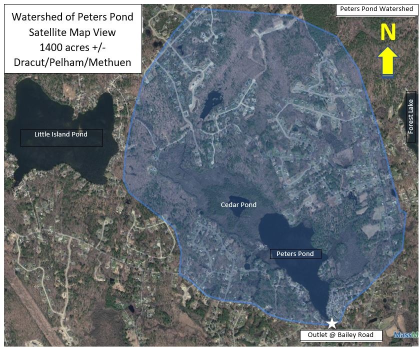
WATERSHED (Satellite Map)
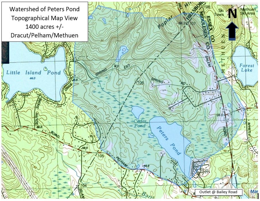
WATERSHED (USGS Topographic Map)
Note: The United States Geological Survey (USGS) topographical maps have not been updated in years. There has been significant development in the northeast area of the watershed, including Autumn, Hidden, and Summer Hill Roads in Dracut. New developments west of Peters Pond include Diamond Drive, Ruby Road, and Coral Drive. In Pelham, new roads to the north and east of Little Island Pond include Stonepost Road and Lannan Drive. All runnoff from land within the watershed - including lawn fertilizers - enters into Peters Pond, contributing to our weed issues.
FLOW IN/OUT OF PETERS POND
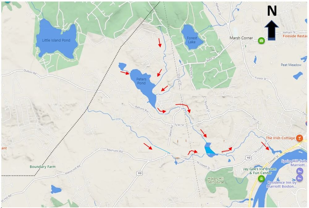
Peters Pond is fed by 3 streams; one from Cedar Pond to the north, and two (un-named) streams entering the southeast quandrant. There is also signficant groundwater discharge ("springs") into the lake. The outlet is at the southern end of the pond, flowing into a small stream that crosses a culvert under Bailey Road, flowing easterly under Salem Road, and then to the southeast under Tyler Street in Methuen. This unamed stream converges with Bartlett Brook in a wetland/pond north of the Hickory Hill golf course, then flows northeast, before a southeast turn brings it to the Merrimack River. There is no hydrologic connection between Peters Pond and Little Island Pond.